The Royal Road of Campeche-Mérida

During the work carried out in the Archaeological Salvage Project of the Tren Maya, not everything excavated is pre-Hispanic, as evidenced by the discovery of remains of the Royal Road that connected the cities of Campeche and Mérida. This reveals an exceptional communication system established during the colonial period, which, until a few years ago, maintained its significance due to commercial exploitation. But, let's take it step by step, what is a Royal Road?
Royal Road between Campeche and Mérida
During the colonial period, the title "royal" was granted to officials or material resources that depended on the king, with the most exceptional case being the Royal Road of Tierra Adentro, which connected the main mining centers of the north with Mexico City (Rocher, n.d.). However, in the Yucatán Peninsula, there were two royal roads whose purpose was to connect the capital Mérida with the region's main ports, San Francisco and Sisal, and to consolidate the subjugation of indigenous peoples. Thus, the first road was known as the "Camino Real Alto" and included the municipalities of Calkiní, Hecelchakán, Tenabo, and Hopelchén. The second road was called the "Camino Real Bajo" and started from Halachó, Maxcanú, Umán, and Hunucmá.
Both roads were initiated when the visitor sent to Yucatán, Tomás López Medel, ordered the construction of roads and causeways in his ordinances. Between 1561 and 1566, the construction of the Camino Real began, which started in 1554 and underwent several improvements throughout its history, even in the 19th century, during the height of henequen manufacturing, when Sisal was its main shipping port.
Excavations on the Campeche-Mérida Royal Road
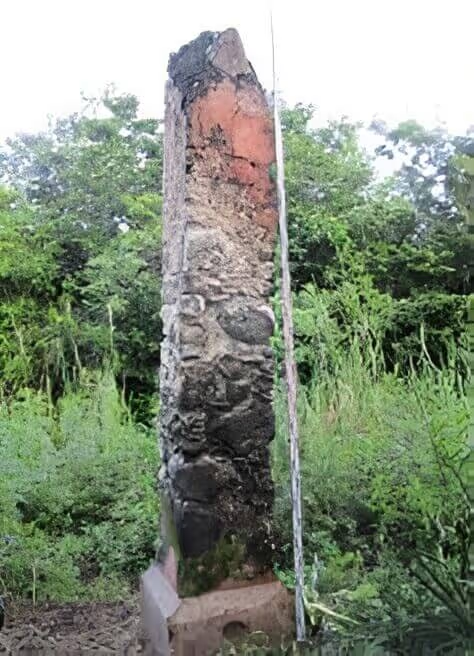
In 2021 and 2022, archaeologists Benavides, Novelo, and Vera, as part of the Archaeological Salvage Project of the Tren Maya, excavated a section of the Campeche-Mérida Royal Road. In the first phase, the Royal Road was mapped using LiDAR technology, which provided a preview of what would later be confirmed during the prospection. It was during this stage that a milestone was located, a column that served as a distance indicator, located a few kilometers from Campeche. This milestone, which was once covered with red plaster, has a square base measuring 3.45 meters and a peak that tapers to a point.
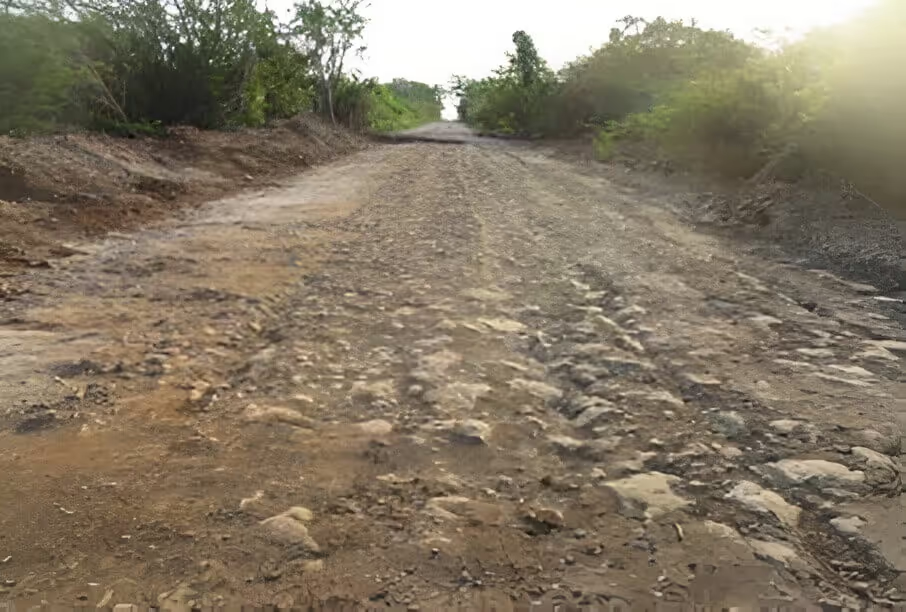
During the excavations of the Camino Real, the construction system was observed. At ground level, a layer of large stones was placed, followed by smaller stones, upon which limestone slabs were arranged to form the pavement. At the edges, carved stones were placed with their edges facing inward, serving as a base for the curbs that delineated the passage for vehicles and pedestrians.
Finally, in addition to the construction system, the Archaeological Salvage work allowed for the documentation of the tracks left by various vehicles that traveled along its surface, such as carts, carriages, or volantes, whose wheels were fitted with steel rims for greater durability.
Without a doubt, the archaeological salvage work has expanded our knowledge of the Maya area, not only in the pre-Hispanic period but also during the colonial and modern eras.
References
* El Camino Real de Campeche a Mérida: orígenes
